I was first introduced to West End as a very young child of the Post World War II generation. My childhood and young adult experiences have carved a place in my memory and in my heart for what was one of the most interesting places in my home city of New Orleans.
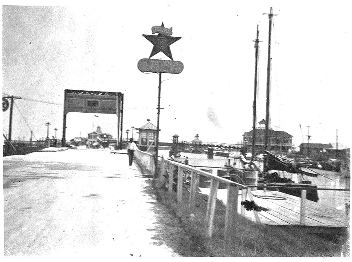
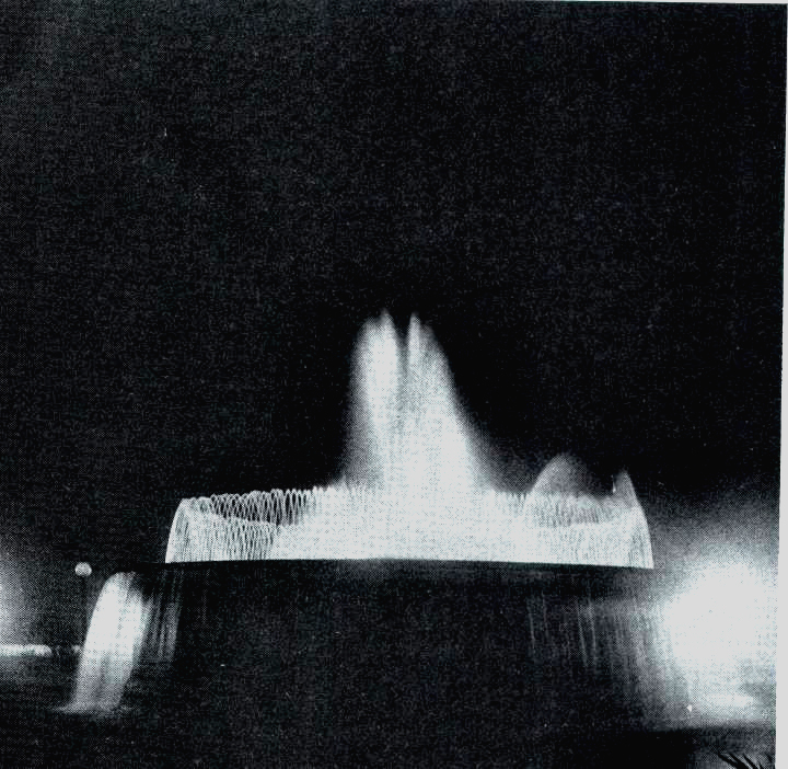
It was always an exciting time when, in the evening, we ventured out in my dad's 1936 Dodge coupe for a night on the town, which usually meant a trip to the New Orleans lakefront. On humid New Orleans Summer evenings in the late 1940s and early 50s, we would make weekly trips on Sunday or Wednesday evenings to West End Park to watch the water show and band concerts at the West End Park Fountain. I can vividly remember walking to the edge of the water filled basin with my father, peering through the thick Ligrustrum hedge that surrounded the outer basin, and watching the crew of workers from the City as they operated the water and light show, by hand, from a little machine room located under the main structure from which the plumes of colored water emerged. There was always an air of excitement when dad steered the old Dodge out on Lakeshore Drive, and the 7UP and red Mobil Oil Flying Horse signs came into view as we were about to drive onto the bridge that crossed the New Basin at West End.
I remember too my first taste of soft-shell crabs on Po-boy sandwiches from the restaurants at the back of the park, where my father often stopped after the weekly fountain water show. My mother was a great fan of soft shell crab po-boys, and it became routine to pick up these wonderful treats whenever they were in season. Driving with open windows (no air conditioned cars in those days) I recall the smell of frying seafood and the chime sounds made by the rigging on the boats in the harbor. There was always that cool breeze that floated across the lake in New Orleans summer evenings, which allowed us to survive in the city's heat and humidity.. While the Po-Boy sandwiches were frequent, on some evenings, after watching the show at the fountain, we would drive along the New Basin levee road on what was West End Boulevard, and we would arrive at the ice cream shop known as The Half Way House on City Park Avenue at the foot of another draw bridge that extended City Park Avenue into Metairie Road.
Years later, as a young adult, I spent evenings fishing from the seawall or watching "submarine races" with ladies I happened to be dating at the time. A road had been extended out onto the breakwater that protected the harbor entrance on what we called "The Point," and by the 1960s it had become a favorite hangout of the dating crowd. In fact, it was while sitting at "the Point" one night that I proposed to the lady who became my wife of forty-five years.
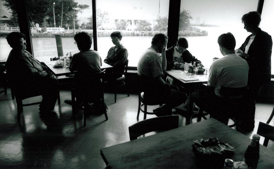
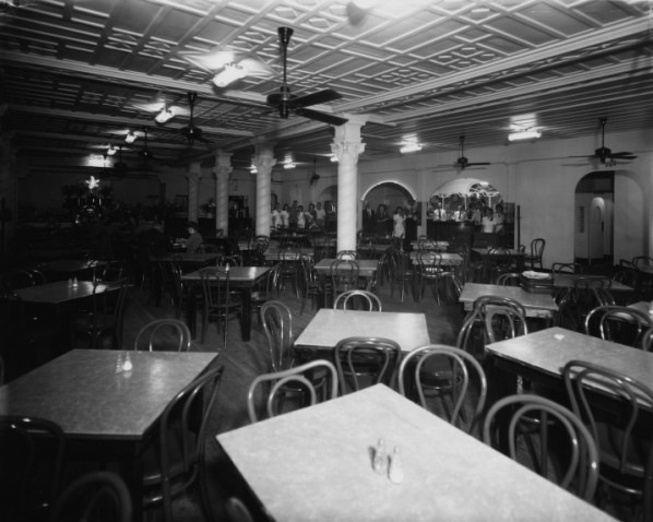
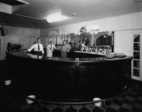
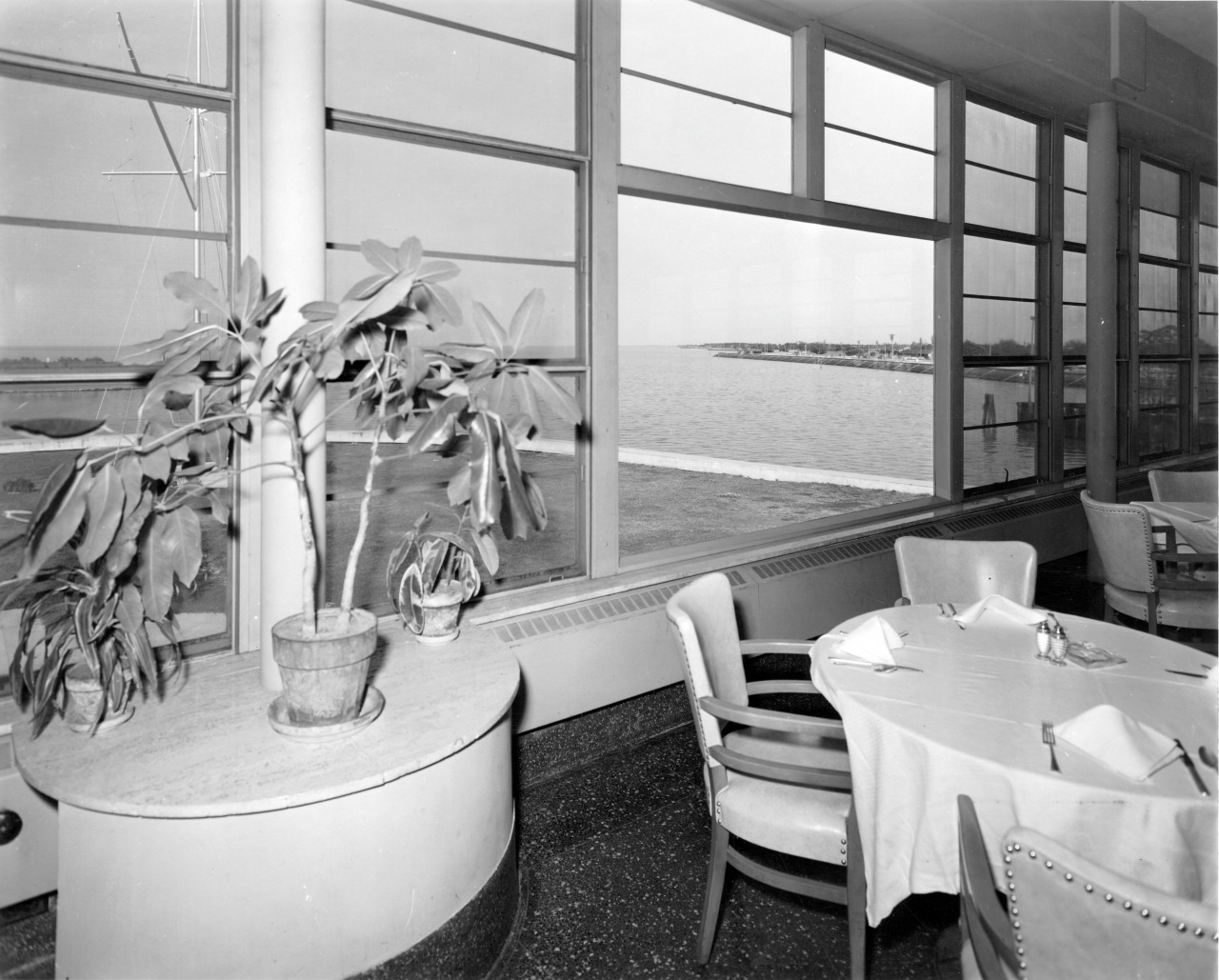
West End was always a favorite a place for special family dining events. Friday night and Sunday dinners with my mother, and my wife, at places like Fitzgerald's, Bruning's, and Papa Rosselli's, was something we did quite often. Although I was never much of a consumer of alcoholic beverages, the experience of a good cold Jax beer, after a meal of salty seafood, really seemed to hit the spot.
Yes, West End was a magical place for a kid growing up on New Orleans's lakefront in the 1950s and 60s. As an adult in the late 1960s, I purchased a 19 foot lightning sailboat and learned to sail at a place called Walet's Yacht Sales on the New Basin Canal. The calm that usually fell over Lake Pontchartrain on summer evenings at sunset, made for some pleasant relaxation and memories with friends who came aboard my little "yacht".
Like most of New Orleans, many changes occurred at West End over the years, some good and some not so good, but when Katrina struck, and I realized that the West End I knew and loved would forever more become just a memory, I decided to document some of the personal and public history that made this once resort park, a place loved by New Orleanians. It was to that end that I decided to assemble this web site which includes old photographs that I had taken over the years, as well as some shared by friends who also appreciated West End. For those of you who might share memories of this unique part of New Orleans culture, I hope that you enjoy this little walk through a time and place that New Orleans folks would say "ain't dere no mo." Please also feel free to share your own photo memories, which I will gladly add to the site if you so desire.
John DeMajo
The early New Orleans lakeshore resort area known as WEST END, dates back to 1835 when it was first founded as "New Lake End." In 1880, the name was changed to West End.
Prior to the reclamation of the shore of Lake Pontchartrain at New Orleans by the Orleans Levee Board and the WPA, the Orleans Parish shore of the lake was mostly swampy land, dotted with over-water fishing camps and three resort communities that were, for the most part built over water. Spanish Fort, Milneburg and West End became popular gathering places for New Orleanians seeking leisure. In the 1860's a boardwalk had been constructed over the swampy area of the lake at the extreme west of Orleans Parish and the Jefferson Parish border. The U.S. Lighthouse Service had constructed a lighthouse at the mouth of what had become the entrance to the "New Canal."
Before the construction of the New Canal, a previous canal existed in New Orleans known as the Basin or Carondelet Canal after the name of its original builder. It was from this waterway that Basin Street, the street immortalized in the familiar Spencer Williams' tune "Basin Street Blues," got its name. The Basin started with Bayou St. John, and ran from Lake Pontchartrain, up along the path that is now St. Louis Street, to the area where Orleans Avenue and Claiborne Avenue meet. It was here that Basin Street was located, one block over from North Rampart. For many years, the old Basin had no levees or flood control, and when the lake tides would rise, sections of the French Quarter would flood badly. This contributed to health problems that plagued the early settlement, and it made future use of much of the land questionable. Once past Bayou St. John, the Carondelet Canal was narrow, and did not allow passage of larger vessels.
By the early 1800s, the need for a new, better designed canal had become evident. A company known as the New Orleans Canal And Banking Company was formed in 1831, for the purpose of obtaining the necessary right-of-way, and for seeing to the construction of the actual canal. The new canal would serve as a passage for barges carrying shells and other building products, lumber, cotton, and other commodities into the heart of New Orleans business and manufacturing area. The planners identified the ideal inlet to the canal as being a slip off of the City's western most end at Lake Pontchartrain, just at the point where New Orleans met Jefferson Parish. A great deal of the land between the Lake and downtown, at the time, was undeveloped cypress swamp, so right-of-way for construction was easy to obtain.
At the time, there was a great influx of Irish immigrants entering New Orleans, mainly due to the "Great Potato Famine" that had devastated Ireland in the early part of the 1800's. The Irish settlers had found refuge in the area of New Orleans now known as the "Irish Channel," and they were mostly destitute and willing to accept any work that came along. The owners of the newly formed canal company recognized that the Irish were a source of cheap labor, and under virtually "Slave" conditions, thousands of Irishmen were put to work on the project, lasting through most of the 1830s. Given the sub-human conditions, hundreds of workers were lost mainly due to disease such as Yellow Fever and Typhoid. There was also little attention paid to safety, and many workers died as the result of accidents during construction. Today, the plight of the New Basin Canal workers has finally been acknowledged, and a monument has been constructed along the former path of the canal, acknowledging the contributions made by an estimated 30,000 workers.
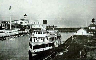
The new canal, and the activity it brought, was partially responsible for the early development of St. Tammany Parish. Shortly after the canal opened to water traffic, a system of steam ferries was established to provide transportation to the towns of Mandeville and Madisonville on the North Shore of the lake. The project had been started by Bernard De Marigny, a plantation owner and one of the city's early businessmen. The ferry service operated into the 1930s when the first automotive highway bridges to Slidell were constructed, first by the Watts and Williams Company, and then by the State of Louisiana under the administration of Governor Huey P. Long. In years prior to the construction of the New Basin, timber and other resources were brought into the city by way of Bayou St. John. There were also a great deal of valuable bald cypress trees existing in the swampy areas close to the New Orleans lake shore in what is now Lakeview. The New Basin provided a way in which those trees could be harvested and exported.
The port of West End was identified as the ideal place for the new canal to open into the lake, and the area had already seen some primitive development from the presence of Marigny's ferry operation. As the canal was completed, and boat traffic began to flow, a resort community soon grew around the West End port. Before long, it was made further accessible by way of a Street railway line that was extended out from Canal Street, and later by car travel on roads that were constructed along the canal banks. By the 1890s a bustling marine resort existed, complete with a board walk, hotel, and several food service, dancing and entertainment establishments. Interestingly, in what can be seen as a parallel to today's shopping malls and resort areas, motion pictures and musical entertainment establishments often found their way into these early resorts..
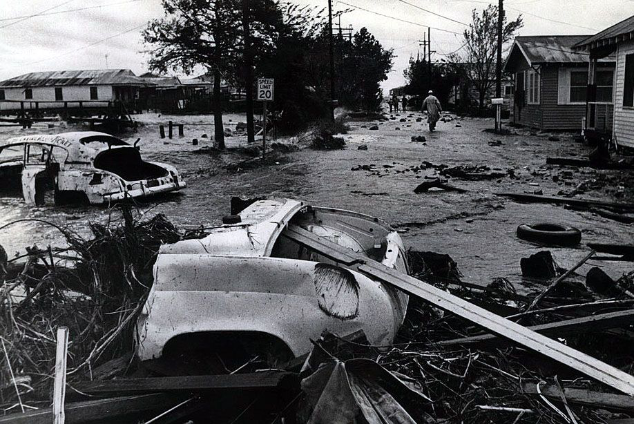
While hurricanes in the Gulf Of Mexico have always posed a threat to the New Orleans lakefront, the hurricane of 1915 caused considerable damage to the over-water West End infrastructure. Because of the massive damage caused by this storm, the city considered an experimental program that would use dredges to pump sand from the lake bottom, and deposit it in the swampy areas along the shore, thereby extending the shoreline and creating dry useable land which did not previously exist. In early 1920s, West End became the first area where this was tried, and seawalls, boat harbors, and a park were built. Dry land now replaced the over-water boardwalk park, which allowed more permanent structures to be constructed, In the 1930s several additional miles of lakefront land were reclaimed by a WPA/Orleans Levee Board reclamation project that produced what is now the seawall that runs the length of the Orleans Parish lakeshore from West End to the Industrial Canal. Throughout the years, West End remained a center of commerce serving both the yacht and private boating interests. By the 1940s, it had also become home to some of New Orleans finest and most notable restaurants, as well as marine service contractors.
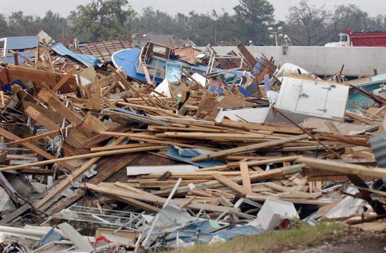
The marine and restaurant trade made West End locations profitable for most of a century, despite the Great Depression, two major wars, and the occasional hurricanes that struck the area. It was not until Hurricane Katrina that the restaurant trade was almost completely eradicated. Katrina also took her toll on the yachting industry at West End as well. Many boats were destroyed, the Southern Yacht Club burned to the ground, and many of the marine service facilities were put out of business due to the extensive damage caused by the wind and flooding. Although the area has seen some slow recovery over a almost two decades since Katrina struck, the original ambience of West End has been lost, and is merely a memory to the declining generation who still remember West End's heyday.
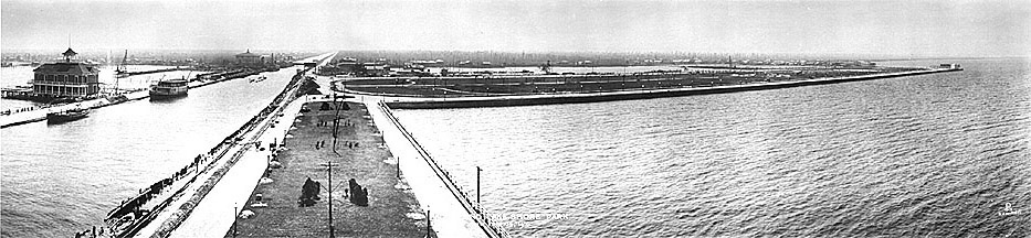
A view of the New Basin Canal at Lake Pontchartrain dating to approximately 1920. (Photo from Wikipedia)
There has been some confusion regarding this 1920s photo. On several sites, it appears to have been reversed, however we believe that this is the correct orientation. The building on the left of the New Basin Canal is believed to be the ferry terminal which serviced the two steam ferries that traveled to and from the North Shore. The large strip of land, protruding to the right, appears to be the beginning of West End Park, having just been turned into reclaimed land, and the body of water behind it would be what was to become the Orleans Marina for the State of Louisiana. The New Orleans Yacht Harbor had not yet been created in this photo, but it would have been on the foreground side of the reclaimed land that became West End Park. The viewer is looking up the canal toward town, and the camera was probably located on the upper floor of the Southern Yacht Club building.
 |
 |
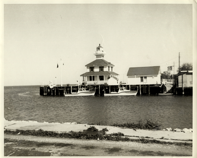
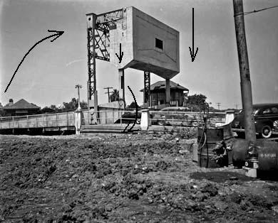
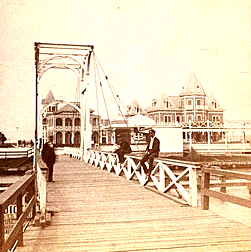
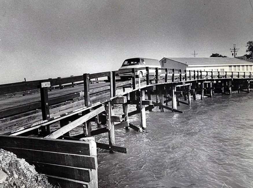
Until the early 1950s, access to West End was limited to a hand operated wooden foot bridge that spanned the New Basin Canal in the area of the present Lighthouse Harbor Condominiums building. That bridge provided access to the boardwalk area which contained amusement park rides, a hotel, restaurants and an open movie theater. In 1921, after much damage was inflicted by the 1915 hurricane, a project by the City of New Orleans filled much of the over-water park area with lake sand, thereby allowing West End to become a land based park. Later, The Orleans Levee Board, with assistance from the Works Progress Administration, reclaimed much of New Orleans' present day Lakefront through the use of dredges that pumped sand from the lake bottom, to behind a concrete bulkhead. This massive undertaking extending the shore of Lake Pontchartrain almost a mile out into the lake. The newly constructed seawall stretched for ten miles, beginning at West End and ending at the new airport constructed at the Southern Railway Seabrook crossing of the Industrial Canal.
By creating a land based park and recreation area at the site of the former over-water resort, construction of permanent docks, boat houses, and marine and food service facilities began to develop in the area. At that time, the old wooden draw bridge, that had provided access to the boardwalk community, was replaced with an electric draw bridge that could handle vehicular traffic. This new electrically operated steel bridge allowed widening of the canal to permit greater access to boat traffic, as well as permitting automobiles to drive into the area alongside West End Park.
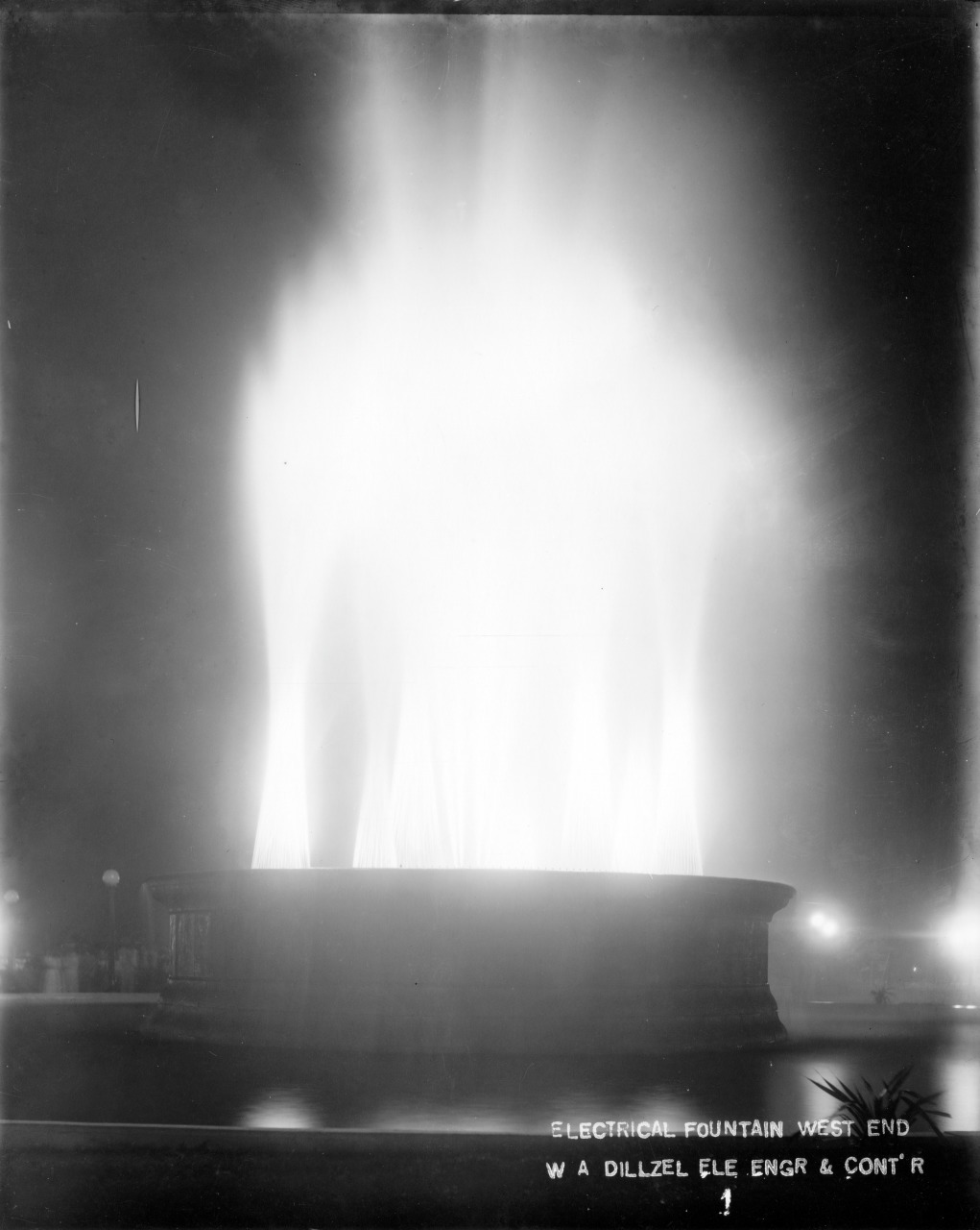
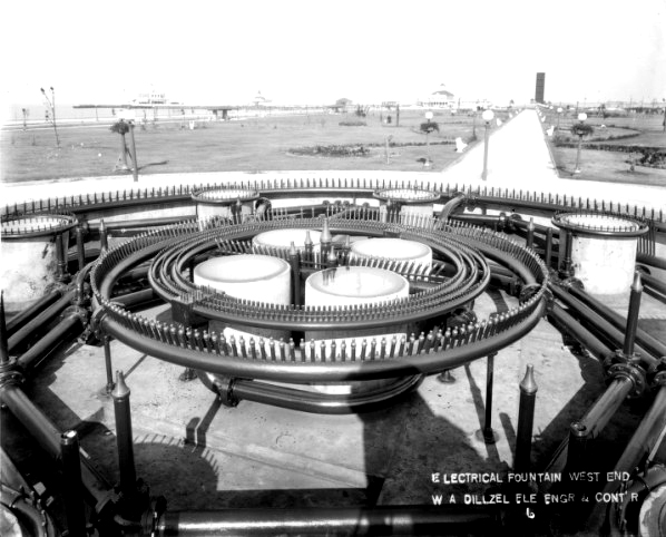
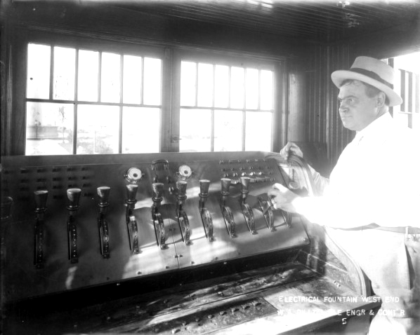
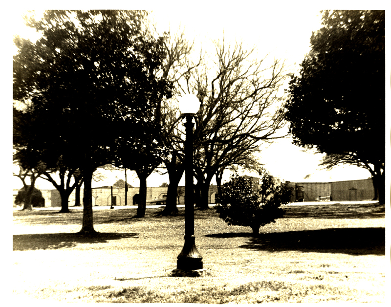
In or about 1923, the City contracted with the Electric Fountain Company Of America to provide a technologically sophisticated (for the period) massive fountain which featured changing light and water patterns that could be adjusted from a remote operator's hut. The new fountain was featured in weekly concerts in the park. The water and lights were given the illusion of "dancing" to the music of live musicians who performed beside the fountain's basin. Often, these shows featured the New Orleans Police Department Band, military bands, or jazz ensembles from the area. Outdoor motion picture shows were also presented in the park until the time when the introduction of talking pictures made the outdoor theatre concept no longer feasible.
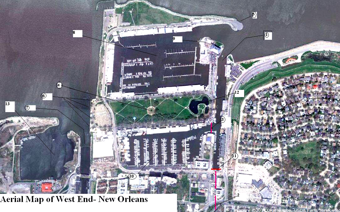
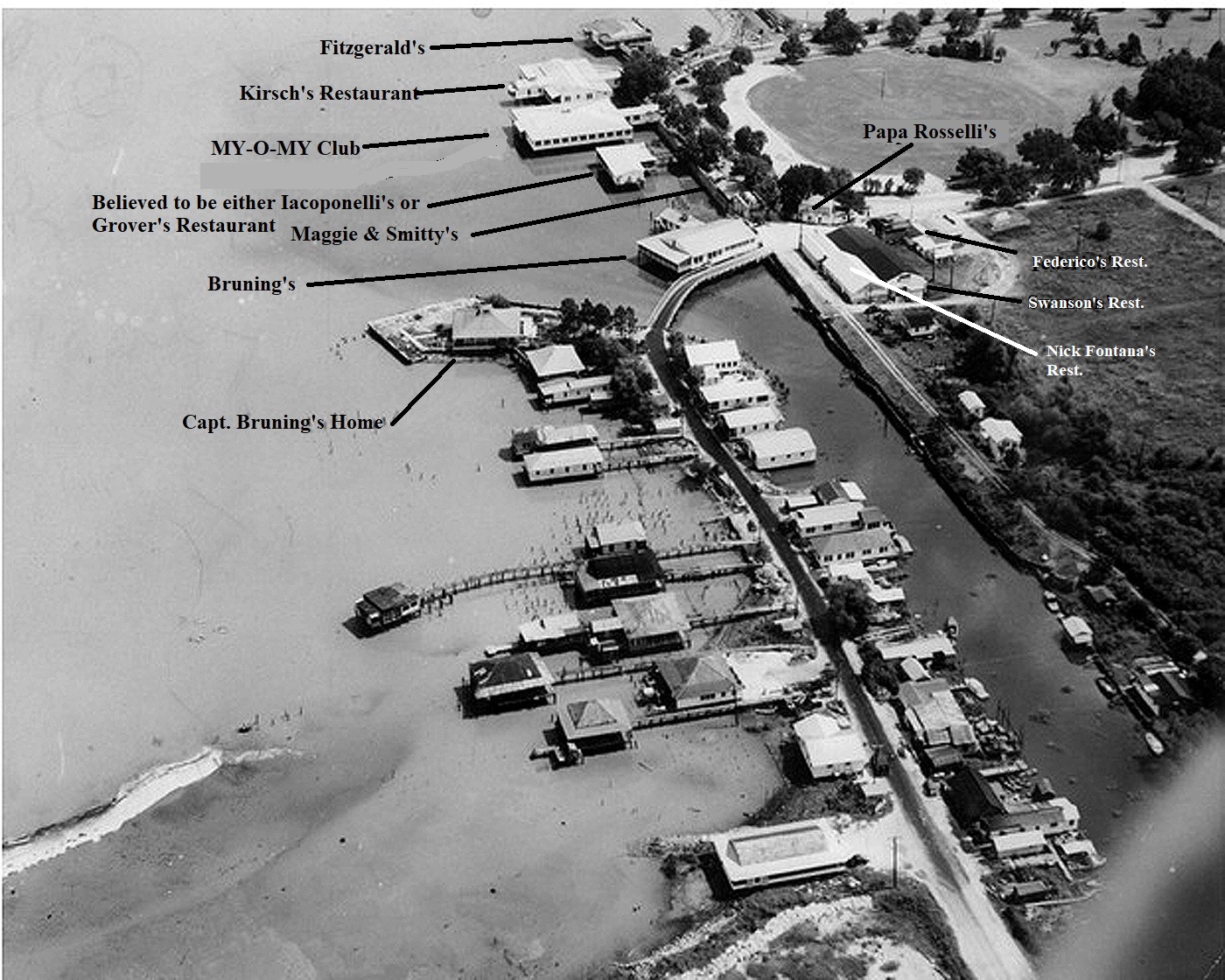
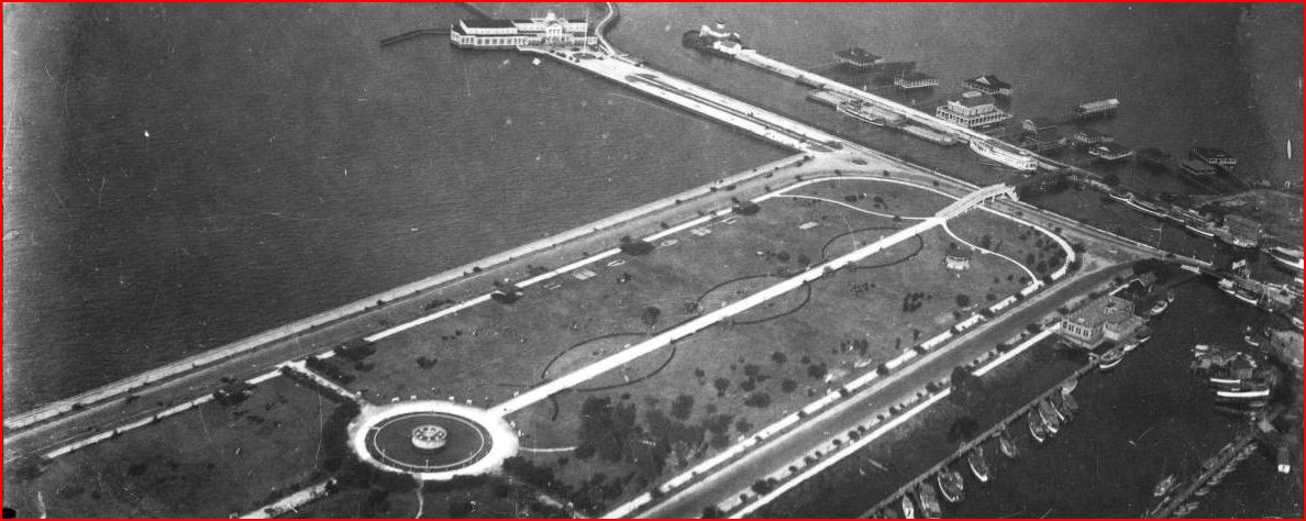
An aerial map of West End showing the locations of the various attractions referenced on this site. (Yahoo Maps)
(LEGEND)
1. The entrance to the New Basin Canal from Lake Pontchartrain.
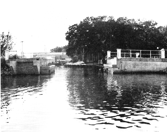
2. The path followed by the canal into the heart of New Orleans. The canal was closed to this point in the early 1950s. It followed the path of the present Pontchartrain Expressway into town, ending at Julia and Howard Avenue near the old Jahncke Materials offices.
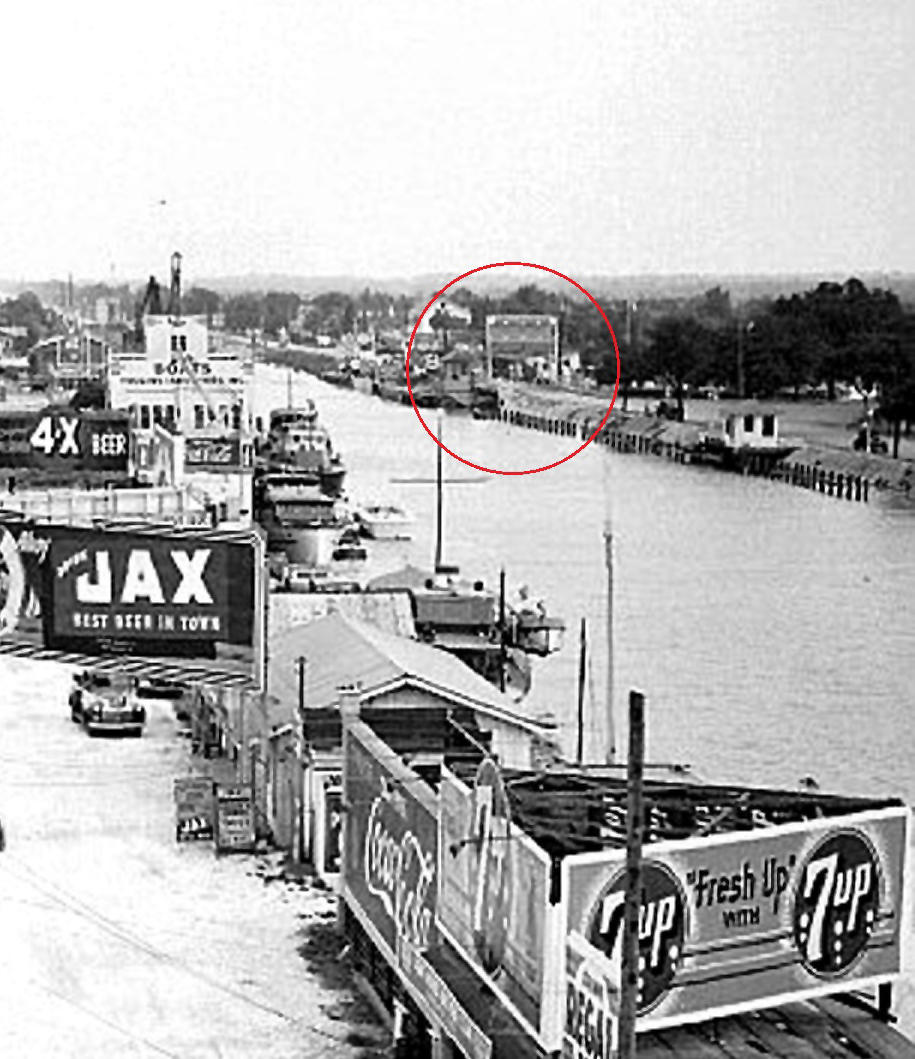
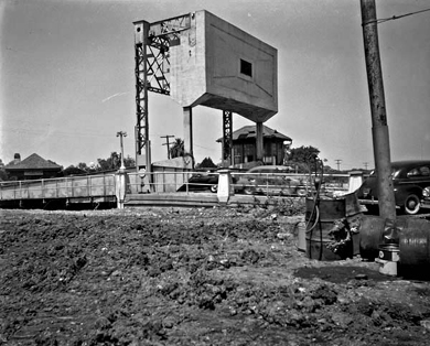
3.
This was the location of the second of two identical draw bridges built in 1921. This bridge spanned the entrance to the yacht harbor. It was removed in the mid-1940s when
increased boat traffic in the harbor rendered it a nuisance because of the repeated need to open the bridge to permit water traffic to pass into the harbor.
Photos of the bridge, before its removal. and also of the piers of the demolished bridge, after the draw was removed, are
shown below.
4. The West End Electric Fountain positioned in the center of West End Park.
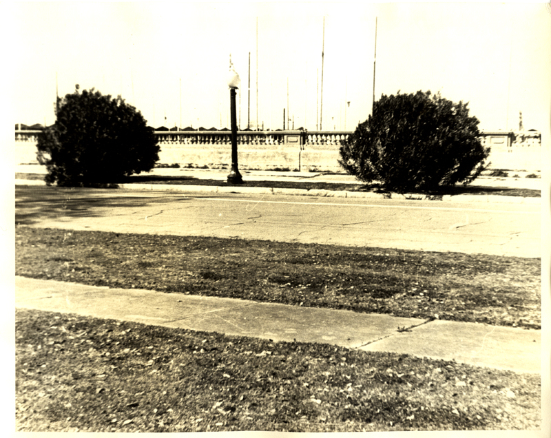
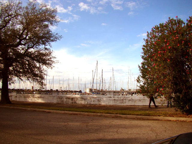
5. The breakwater. Originally this was just a bulkhead that was not accessible to cars. In the 1950s a road was extended out to the end of the breakwater, which was known to New Orleanians as "the Point." The roadway was given the name Breakwater Drive.
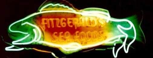
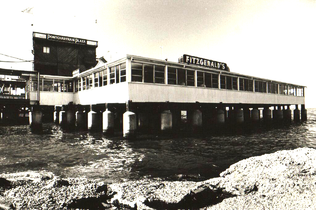
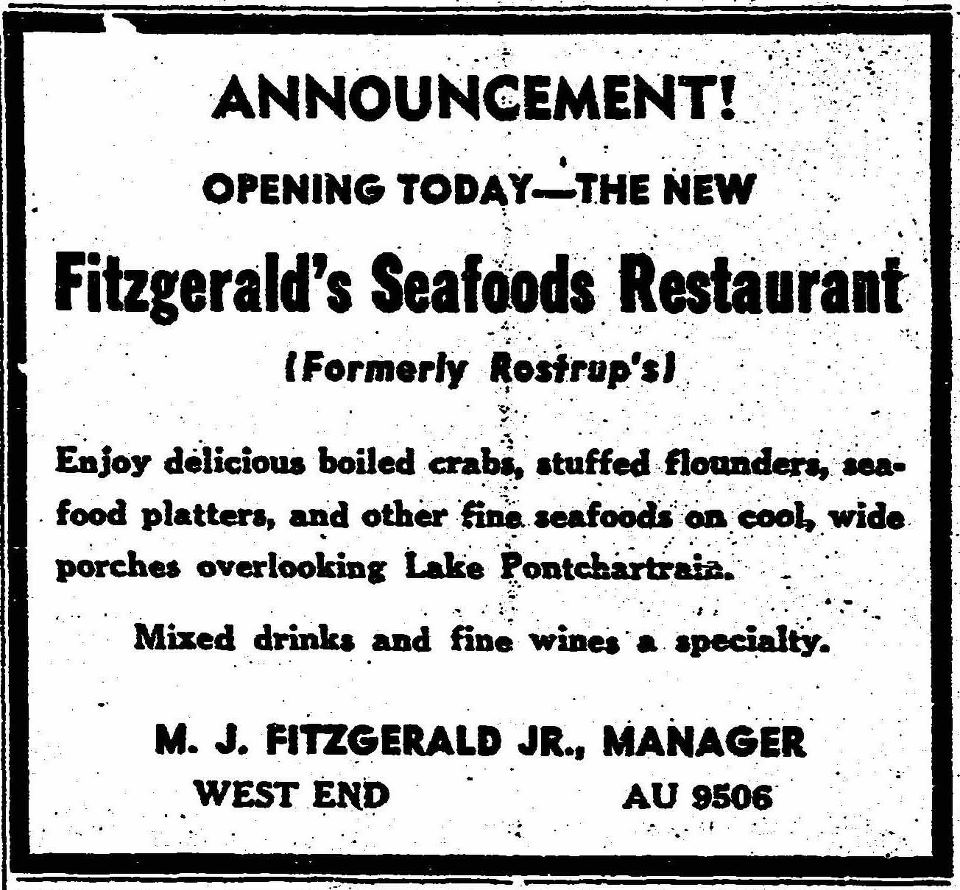
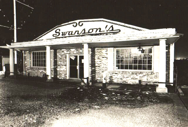
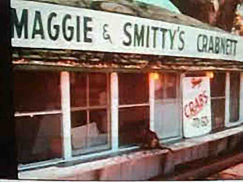
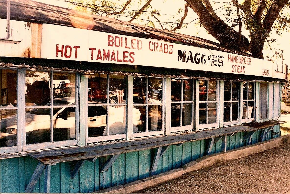
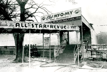
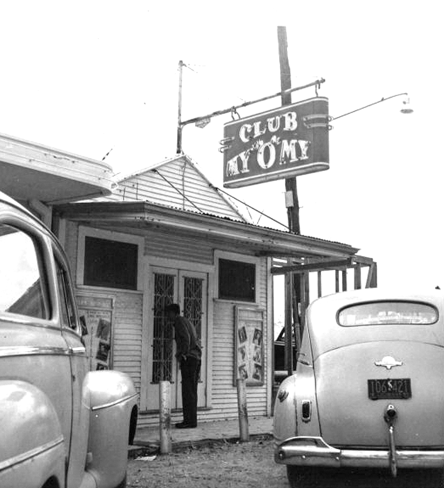
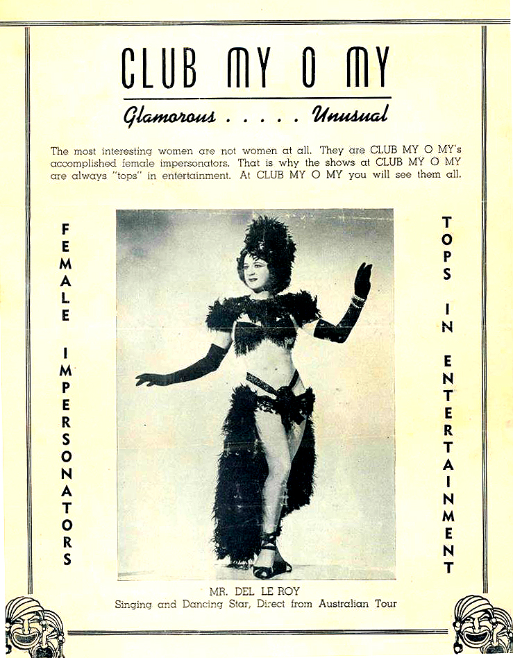
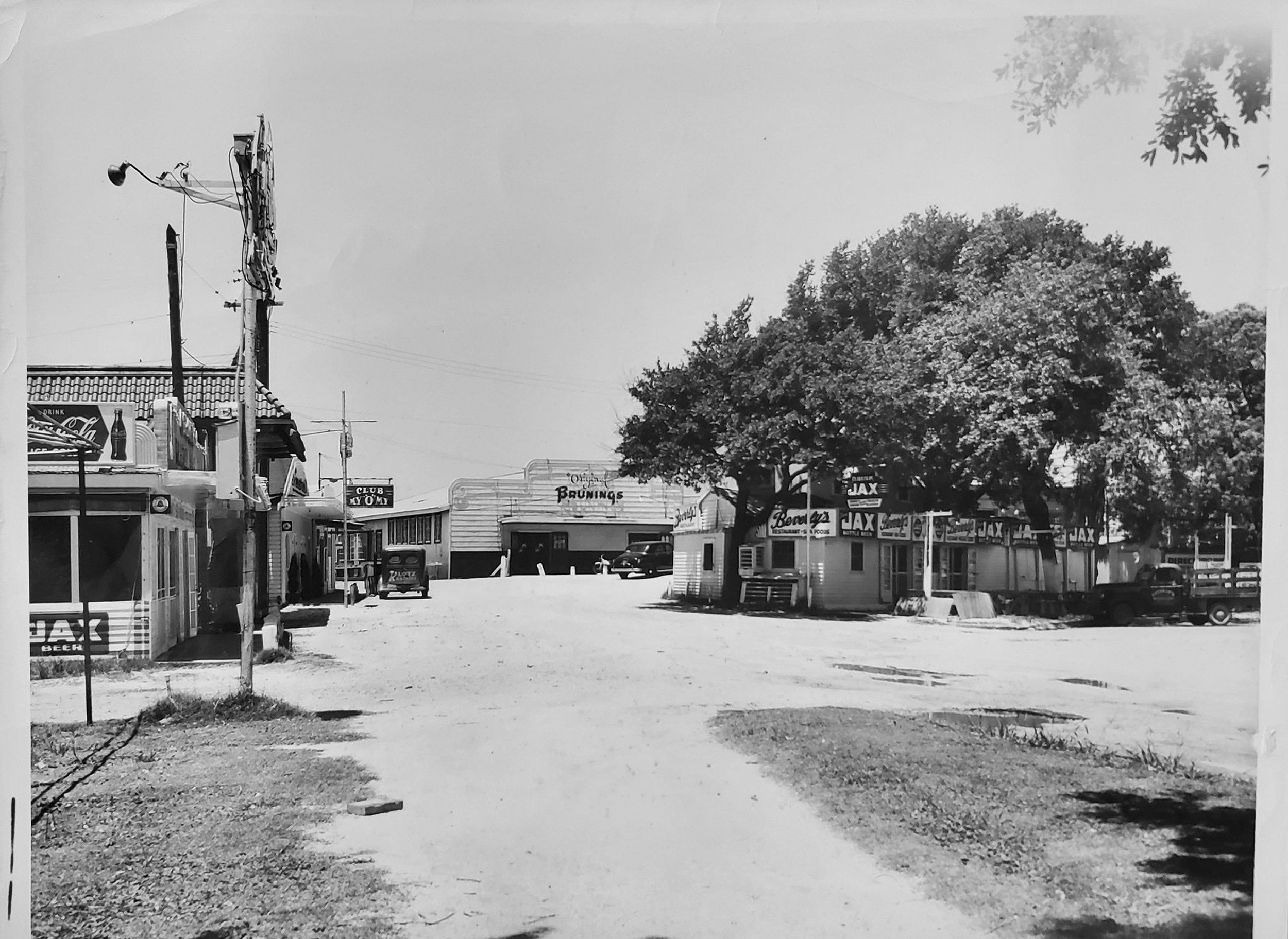
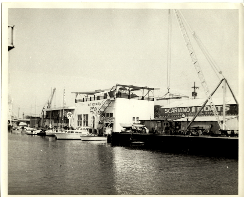
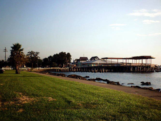
6. Restaurant Row, the location of many of the original seafood restaurants, which were constructed on pilings over lake water. Over the years, these included such noted establishments as Maggie & Smitty's, Bruning's, Papa Rosselli's, Fitzgerald's, Kirsch's, Swanson's, Federico's and the original My-O-My, a club which featured female impersonators as entertainers. Many of the restaurants were technically located in Jefferson Parish, so although they were accessible by land only from Orleans Parish,
7. The entrance to the 17th. Street Outfall Canal. The canal was part of the New Orleans Sewerage and Water Board drainage system, but it also formed the divide between Orleans and Jefferson Parishes. Land to the West of the canal, near the West End portion of New Orleans, was known as "Bucktown, " a village mostly inhabited by fishermen who fished the lake commercially.
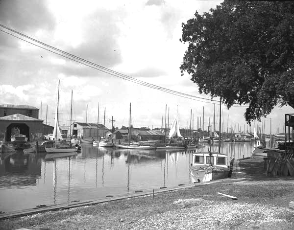
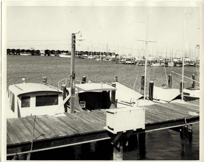
8. The public yacht basin. The area to the front of this basin was exclusively for the use of the Southern Yacht Club, while the area toward the Jefferson Parish line was available for lease by the general public.
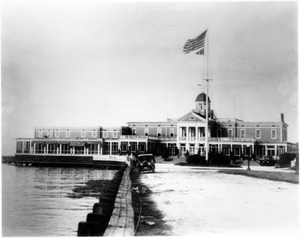
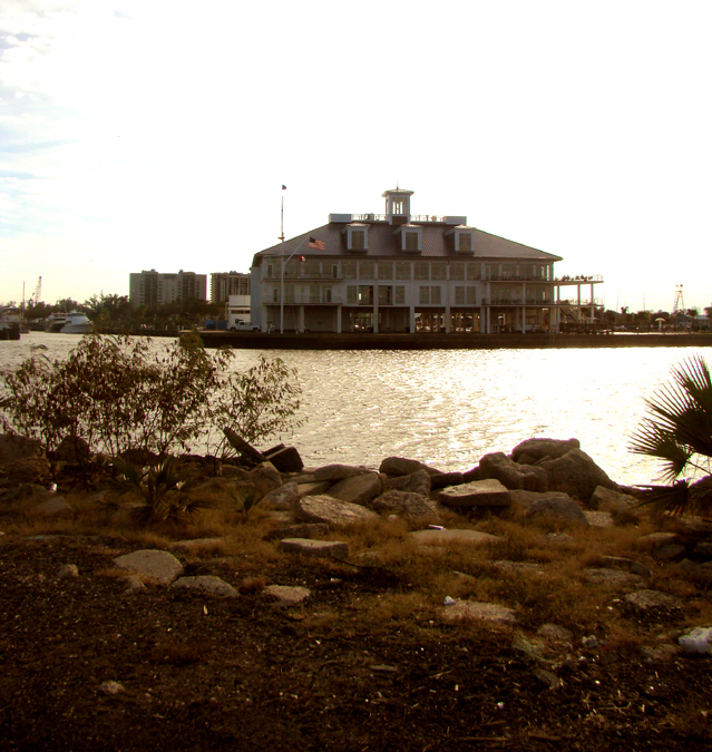
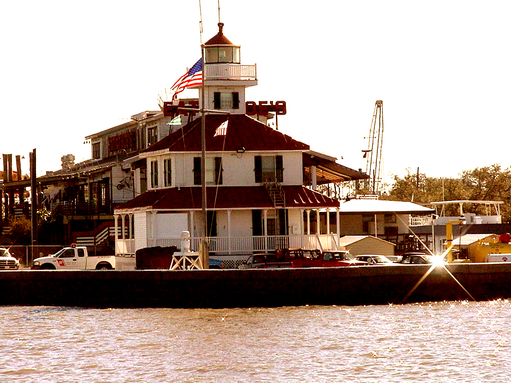
9. The location of the Southern Yacht Club, second oldest yacht club in the United States. The first club house was built on this location in 1879. It was replaced with a new grand building in 1899. In 1920 the structure was renovated and enlarged. By 1949, the old building had deteriorated from age and from the great hurricane of 1947. It was again replaced by the third new building in the history of the prestigious organization. The 1949 building served as the club's headquarters until the time of Hurricane Katrina when it was destroyed by a fire that, left unchecked, burned for days. The Southern Yacht Club is now working to construct their fourth club house.
10. The Orleans Marina operated under the direction of the Orleans Levee Board and the State of Louisiana.
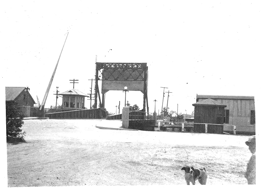
11. The site of the first electric draw bridge accessing West End (shown in the photo below). This bridge was the only access to West End for the first half of the Twentieth-Century. The bridge tied West End Boulevard / Lakeshore Drive to the West side of the New Basin Canal at what is now Lake Marina Avenue.
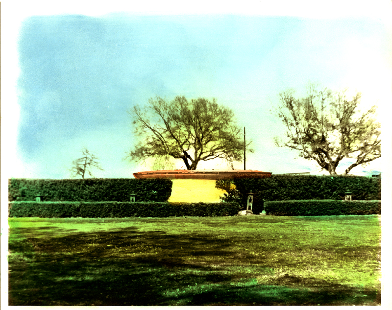
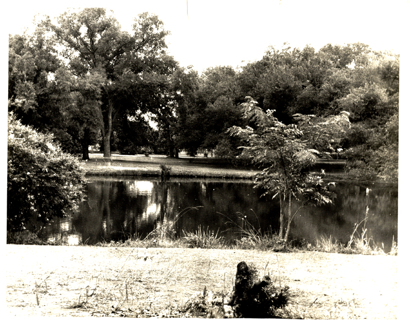
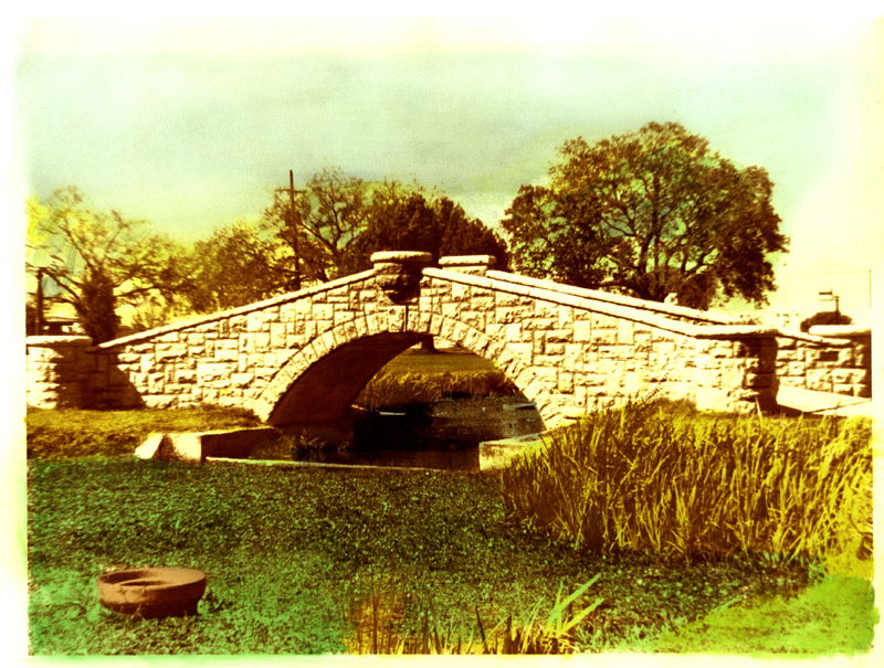
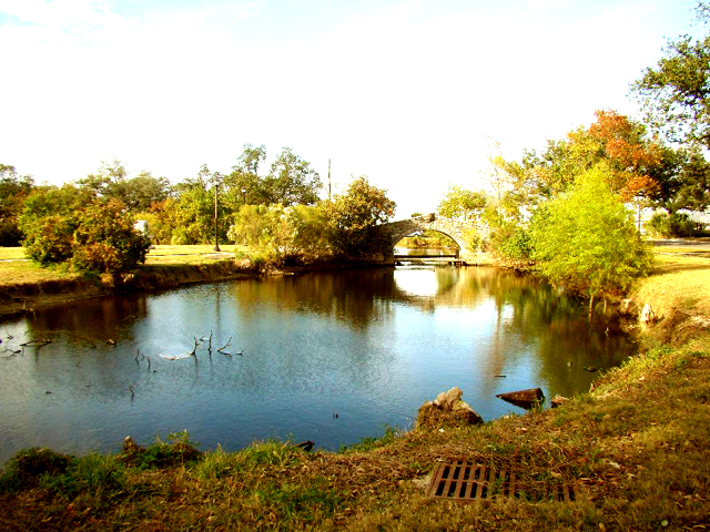
12. Magnolia GrandiFlora Grove and the West End Park lagoon and bridge which were constructed by the Works Progress Administration during the Great Depression.
13. The present site of the proposed Bucktown Marina. This area was part of Lake Pontchartrian until a breakwater was constructed in the late 1990s. The land along this part of the lakeshore came to be known as "Bucktown."

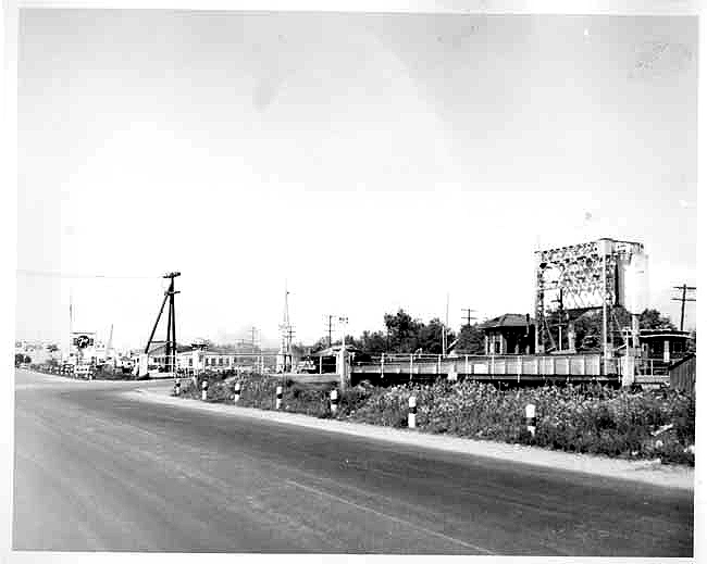
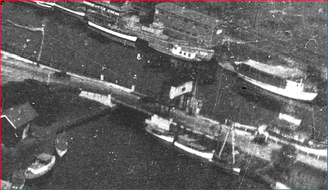
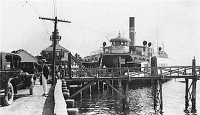
In this mid-1940s view, the second bridge had been removed, and only it's foundation remains. The bridge had become a nuisance in that it had to be raised and lowered constantly as boats entered and left the harbor. Eventually by the late 1950s, even the foundation was removed, and the entrance to the harbor was widened. The rare photo below is one of the only remaining photographs in which the entire bridge appears.
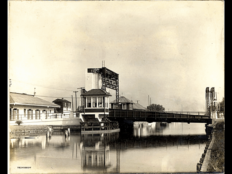
(Photo by Kathleen DeMajo Adams)
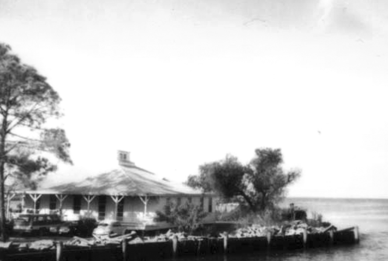
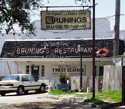
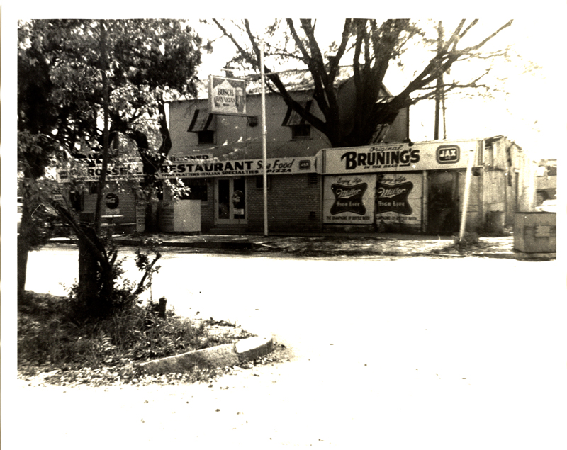
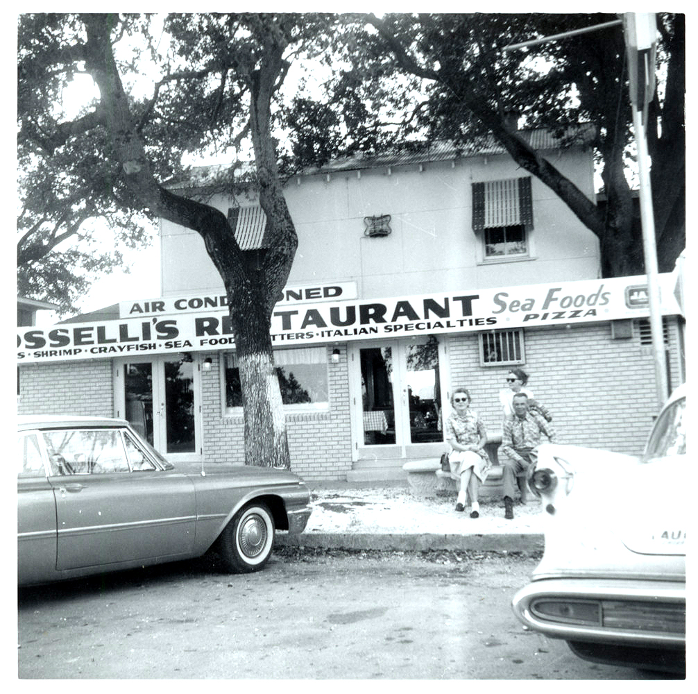
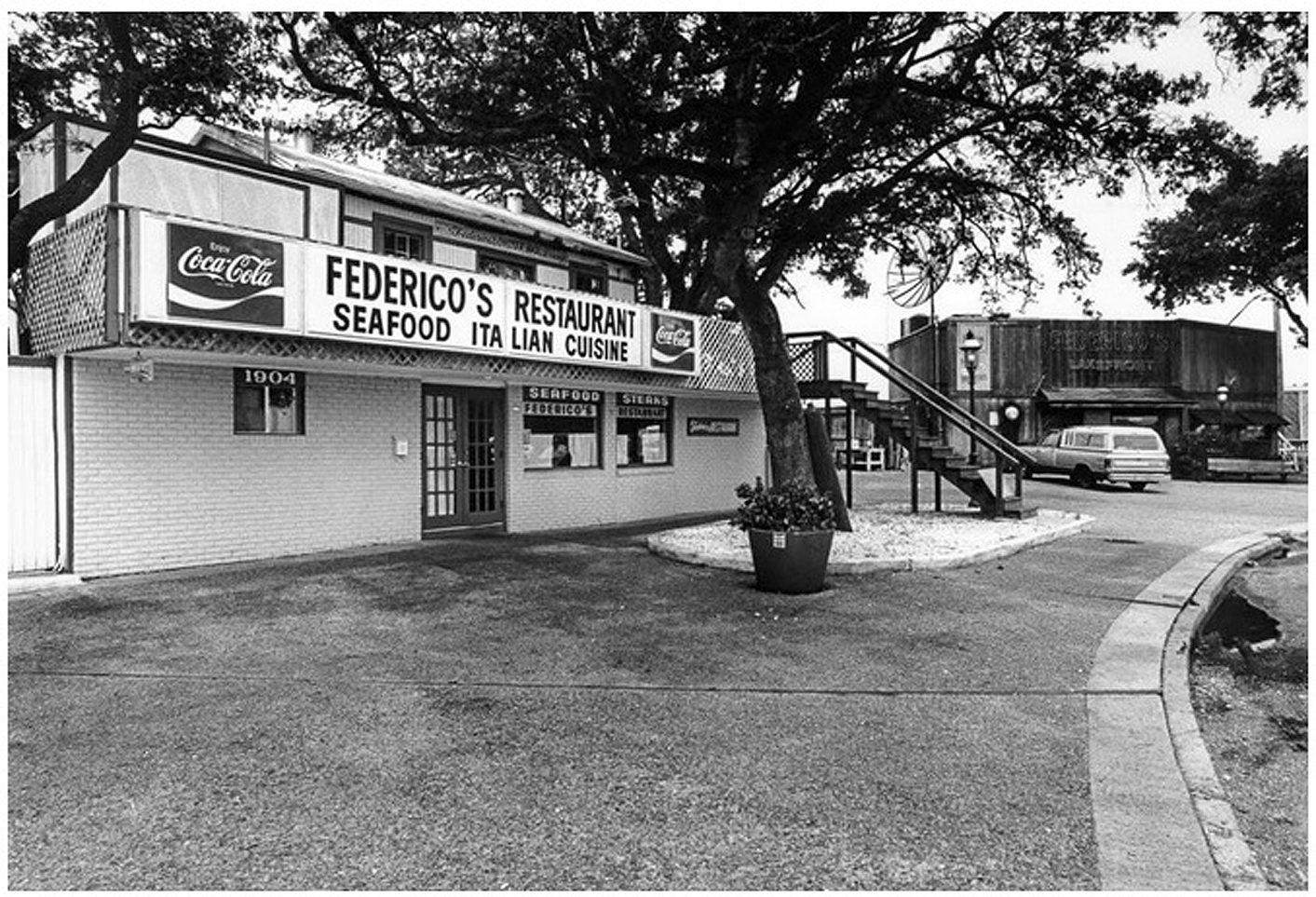
Next to Brunings was the location of Papa Rosselli's Restaurant, 1904 West End Park, which featured some of the best Italian dishes offered in New Orleans. Dominick Rosselli owned a restaurant in the French Quarter that opened in 1920. The West End location was established in 1961. After the Rosselli family retired and closed the restaurant, Brunings moved into the building after the original Bruning's building was damaged in Hurricane Georges (1998).
 |
 |
Photos above and below courtesy of Mr. Frank A. Gagliano.
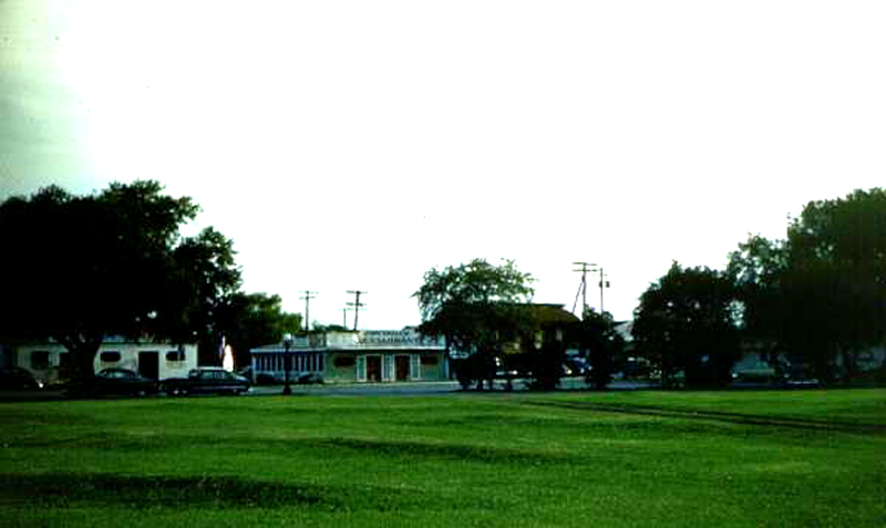
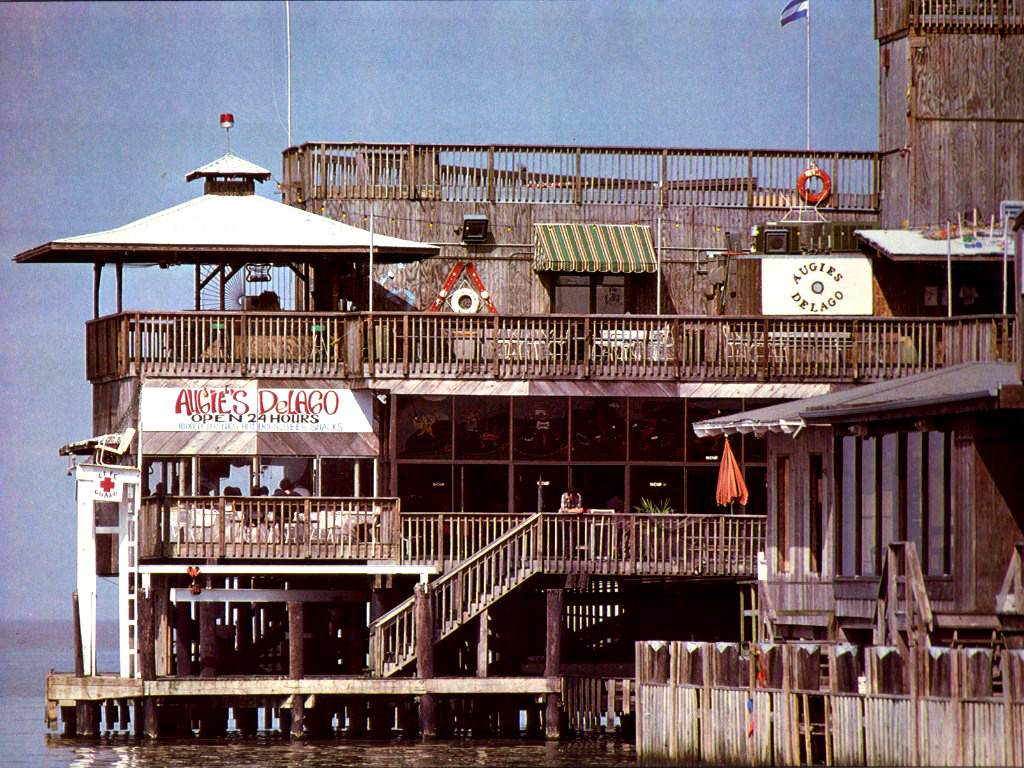
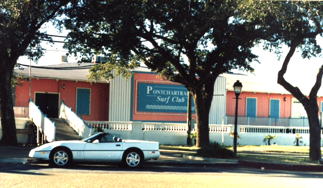
Later in the history of West End, there were several new restaurants and clubs built along the West End Park seawall near to the previous location of the old My-O-My Club which was destroyed by fire. Shown above and below are photographs of the Pontchartrain Surf Club and Neo Beach. Other additions in this same era included Augie's, which was later joined by Yaegers, The Dock, and others. In the early 1990s, the area suffered the effects of Hurricane Georges which, at the time, completely wiped out Fitzgerald's and damaged a number of other restaurants in that area
AND WEST END FOUNTAIN
The photo above shows West End Park in the early 1920s, just after the land under the old boardwalk had been reclaimed as dry land. The remains of the original foot bridge were still in place at the time, and it obviously predates the 1930s reclamation of land that formed Lakeshore Drive and Lake Vista. By reclaiming this land, the Orleans Marina was created at the lower right, however the New Orleans Municipal Harbor and breakwater had not yet been constructed to the left of the park. The photo also predates the construction of the lagoon that was later built at the canal end of the park, and the landscaping does not seem to show Magnolia Grandiflora Grove, all of which were WPA 1930s projects.
 |
 |
THE OLD NEW ORLEANS-HAMMOND HIGHWAY
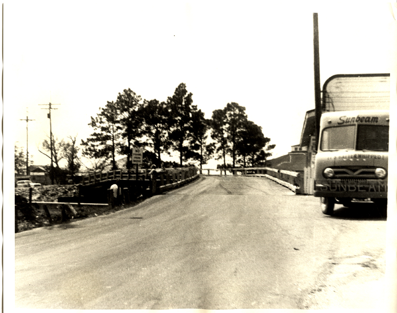
The New Orleans Hammond Highway, which ran north through most of the United States, began at this location next to Bruning's Restaurant in West End. The road followed the approximate route of today's US Highway 51, which is now paralleled by Interstate 55. While remnants of the road are still visible when traveling through Bucktown, the great hurricane of 1947 destroyed most of the infrastructure in the area between West End and LaPlace, Louisiana. Although US Highway 51 was eventually restored beginning at LaPlace, the connection between LaPlace and Bucktown was never replaced.
(Photo courtesy of a viewer of our site)
(Photo below by Kathleen DeMajo Adams)
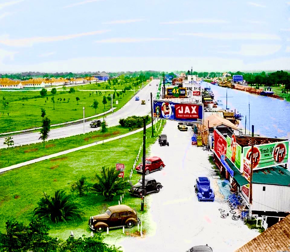
View of the New Basin Canal in the area just outside of West End going toward City Park Avenue and Metairie Road. This photo is from the files of my late uncle, William J. Bogan, who shot the photo in 1938. The original photo is now housed in the Historic Louisiana Photography Collection of the LOUIS Digital Library.
A NOTE FROM THE CREATOR OF THIS SITE: I am continuing to seek photographs of West End which I can use on this site to supplement those which are in my private collection. I would especially like to obtain copies and permission to publish photos of the insides of the various restaurants from the 1940s - 1970s, as well as exterior or interior photos of any of the buildings or fixtures from the area. Please contact: jdemajo(at)demajo.net (substitute @ for the word "at") if you have any photos to share. For many years, I have searched for photos of this great part of New Orleans history, so I am counting on you, the viewers of the site, who share my love for this unique part of our New Orleans past, to help me continue to build and improve the site.
If you would like to see additional pictures of the West End area from the Franck-Bertacci collection housed in the LOUIS digital library,
please visit this link: http://cdm16313.contentdm.oclc.org/cdm/search/collection/CLF/searchterm/West%20end/field/all/mode/all/conn/and/order/date/page/1
This site is dedicated to my late parents, John R. and Edith B. DeMajo. Throughout their lives, West End was one of their favorite places to spend leisure time. Many thanks also to my daughter, Kathleen DeMajo Adams, who was able to return to New Orleans to capture the post-Katrina photographs shown on this site.
John DeMajo
Copyright © 2023, John DeMajo and the The Museum Of Yesterday, Chesterfield, VA